OVERVIEW
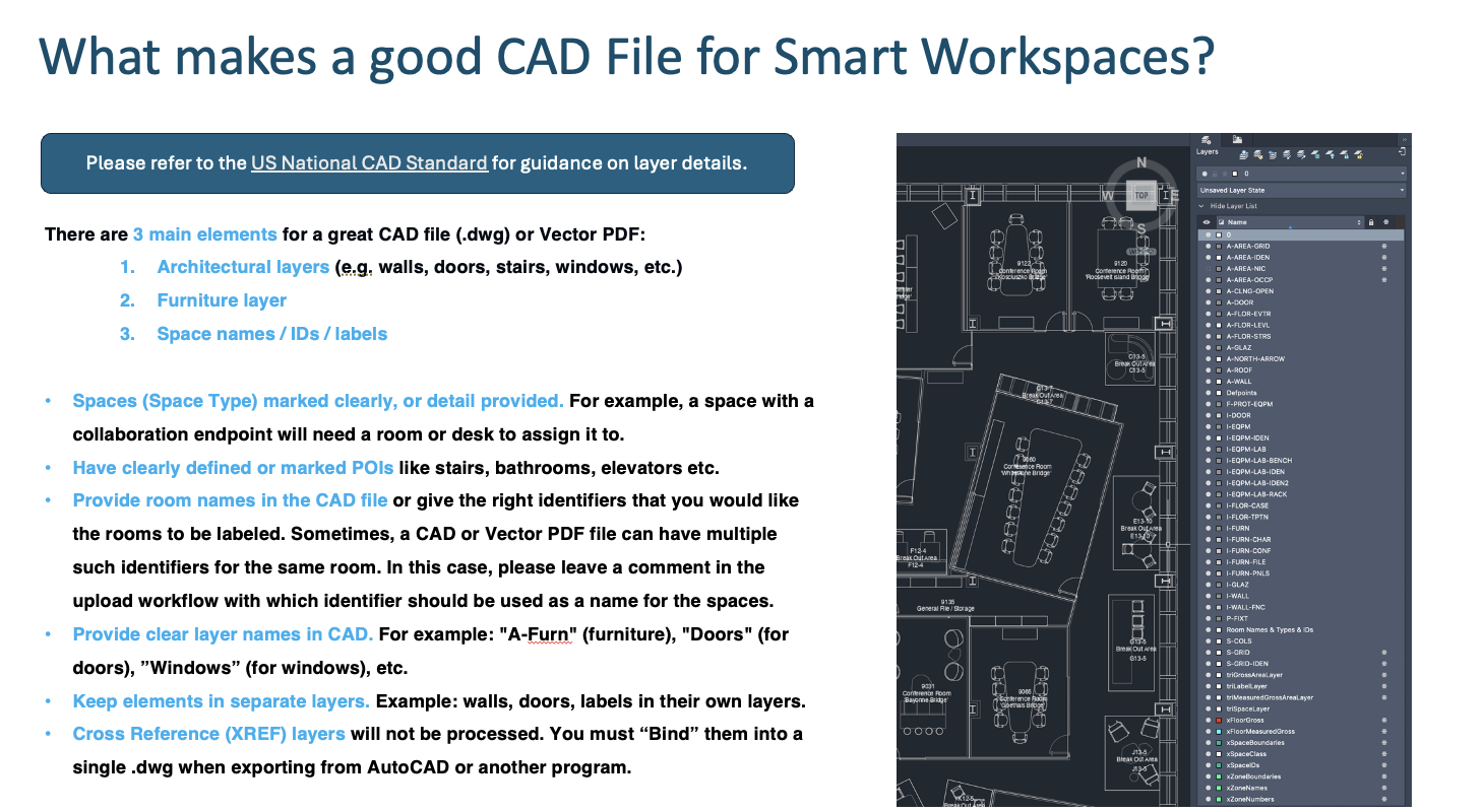
CAD File Overview
There are 3 main elements for a great CAD file (.dwg) or Vector PDF:
-
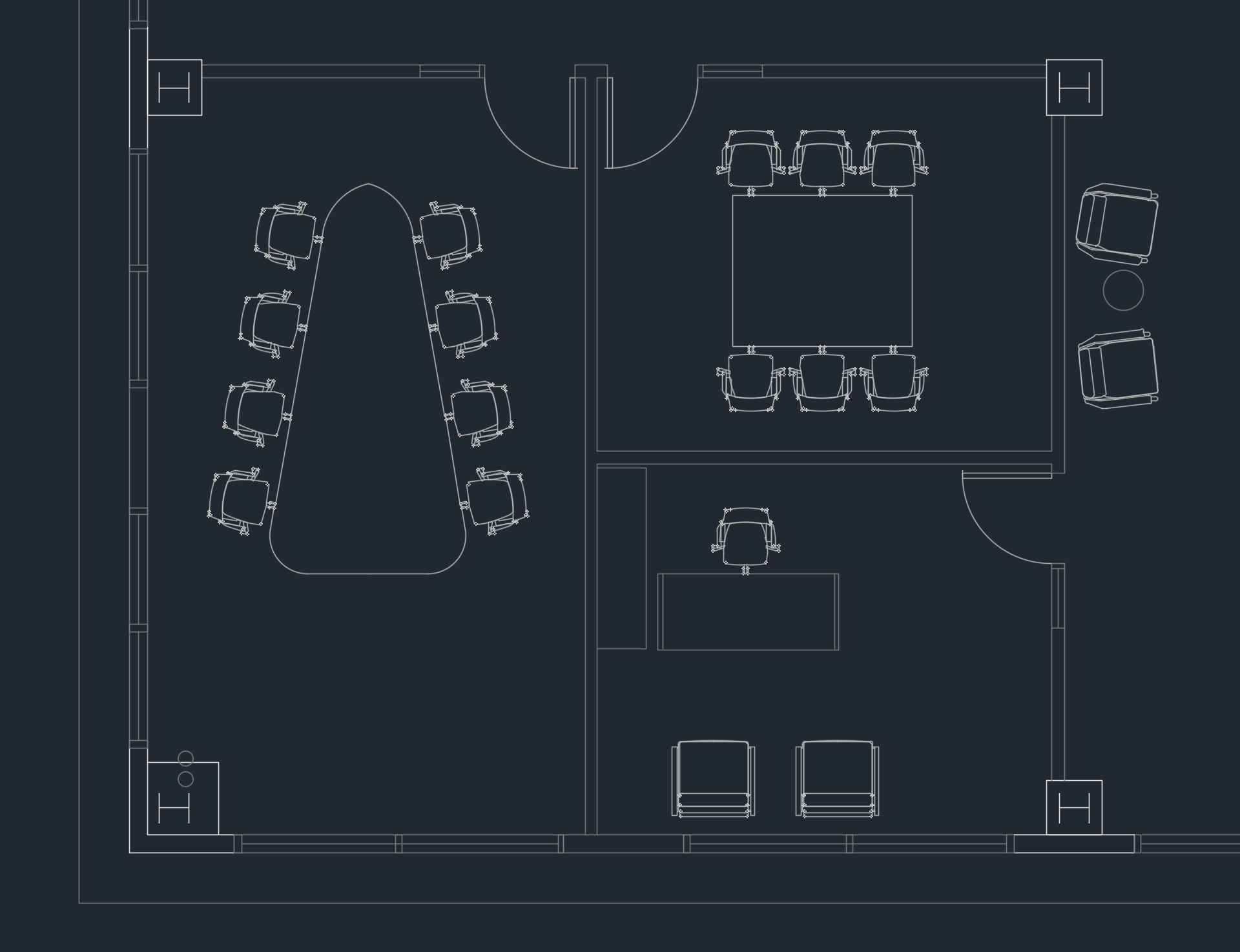
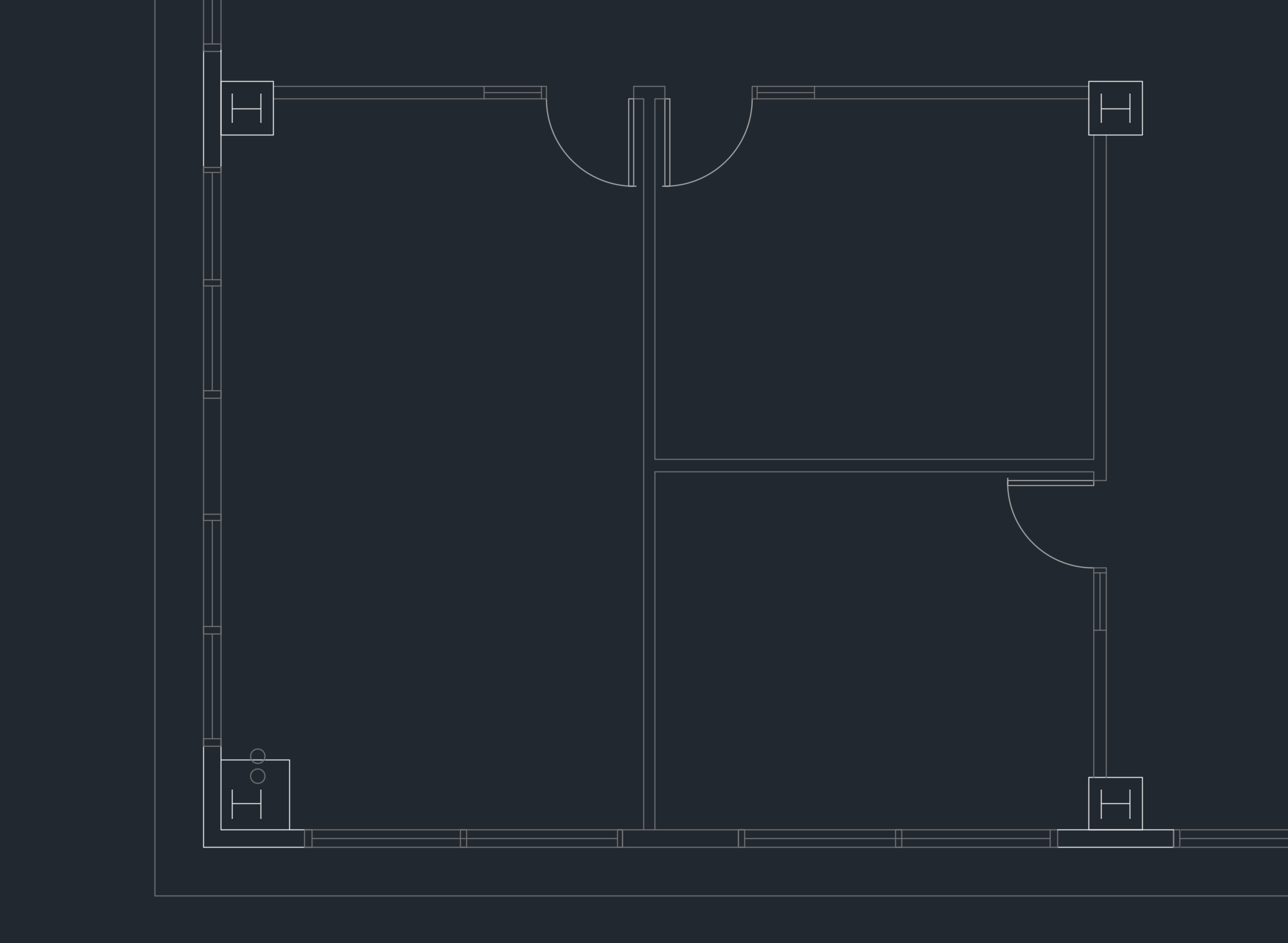
Architectural layers (e.g. walls, doors, stairs, windows, etc.)
-
Furniture layer
-
Space names / IDs / labels
CAD File Best Practices
-
Spaces (Space Type) marked clearly, or detail provided. For example, a space with a collaboration endpoint will need a room or desk to assign it to.
-
Have clearly defined or marked POIs like stairs, bathrooms, elevators etc.
-
Provide room names in the CAD file or give the right identifiers that you would like the rooms to be labeled. Sometimes, a CAD or Vector PDF file can have multiple such identifiers for the same room. In this case, please leave a comment in the upload workflow with which identifier should be used as a name for the spaces.
-
Provide clear layer names in CAD. For example: "A-Furn" (furniture), "Doors" (for doors), ”Windows” (for windows), etc.
-
Keep elements in separate layers. Example: walls, doors, labels in their own layers.
-
Cross Reference (XREF) layers will not be processed. You must “Bind” them into a single .dwg when exporting from AutoCAD or another program.
-
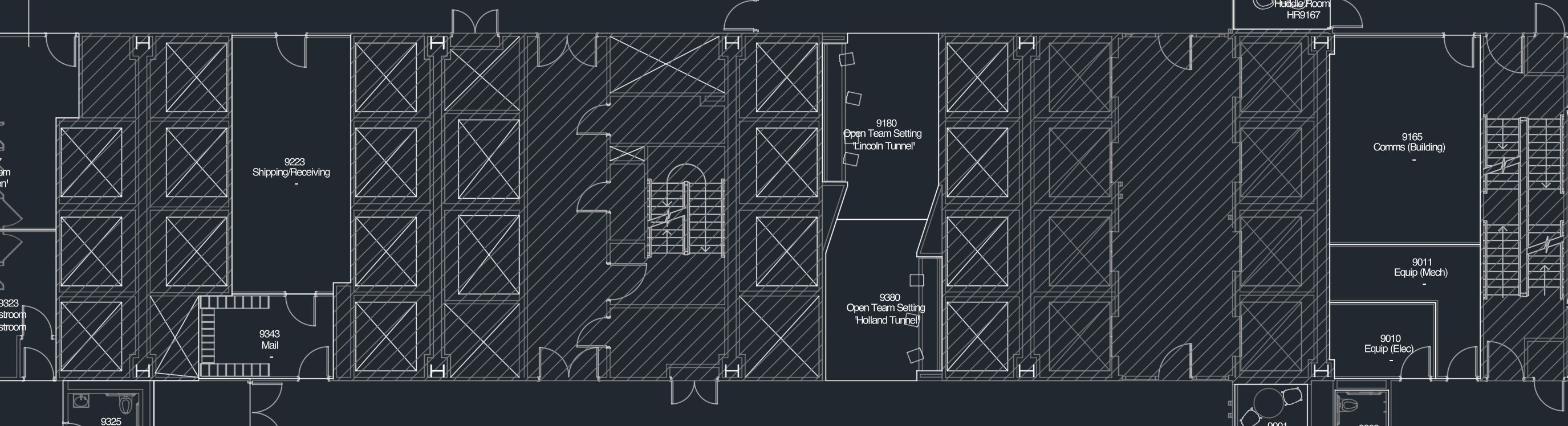
Add/remove Hatch Patterns from rooms to block out / show specific areas of the map. Hatched areas will be given 100% wall height in the 3D styling and metadata in the area will not be processed.
SPACE TYPES
Overview
There are concepts to understand when setting up and configuring Cisco Spaces AI Digital Maps that have implications throughout the platform. To establish a consistent ontology/terminology, please refer to the terms below:
-
Space Type - finite, structured list of categories of spaces/rooms/bounded areas, for grouping many of these into consistent types. Different locales/regions/companies have different terms for each of these, but the concept for each space type should be somewhat universal when accounting for synonyms. End users do not usually think in terms of Space Types, except through the lens of any UI. Search in this field should surface results based on a synonym list per type. Great for filtering and grouping.
-
Space Name - additional context, typically unique and how end users usually perceive the various spaces. Great for end user search, labels, etc. A Space Name can be identical to a Space ID, for example, a desk ID.
-
Space ID - typically permanent identifiers. Great for machine-to-machine matching. Not usually useful to end users or admins in many cases.
User Interfaces:
-
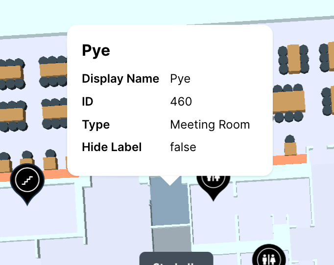
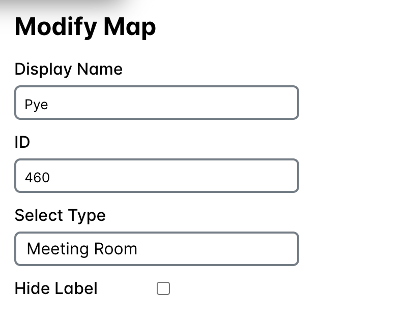
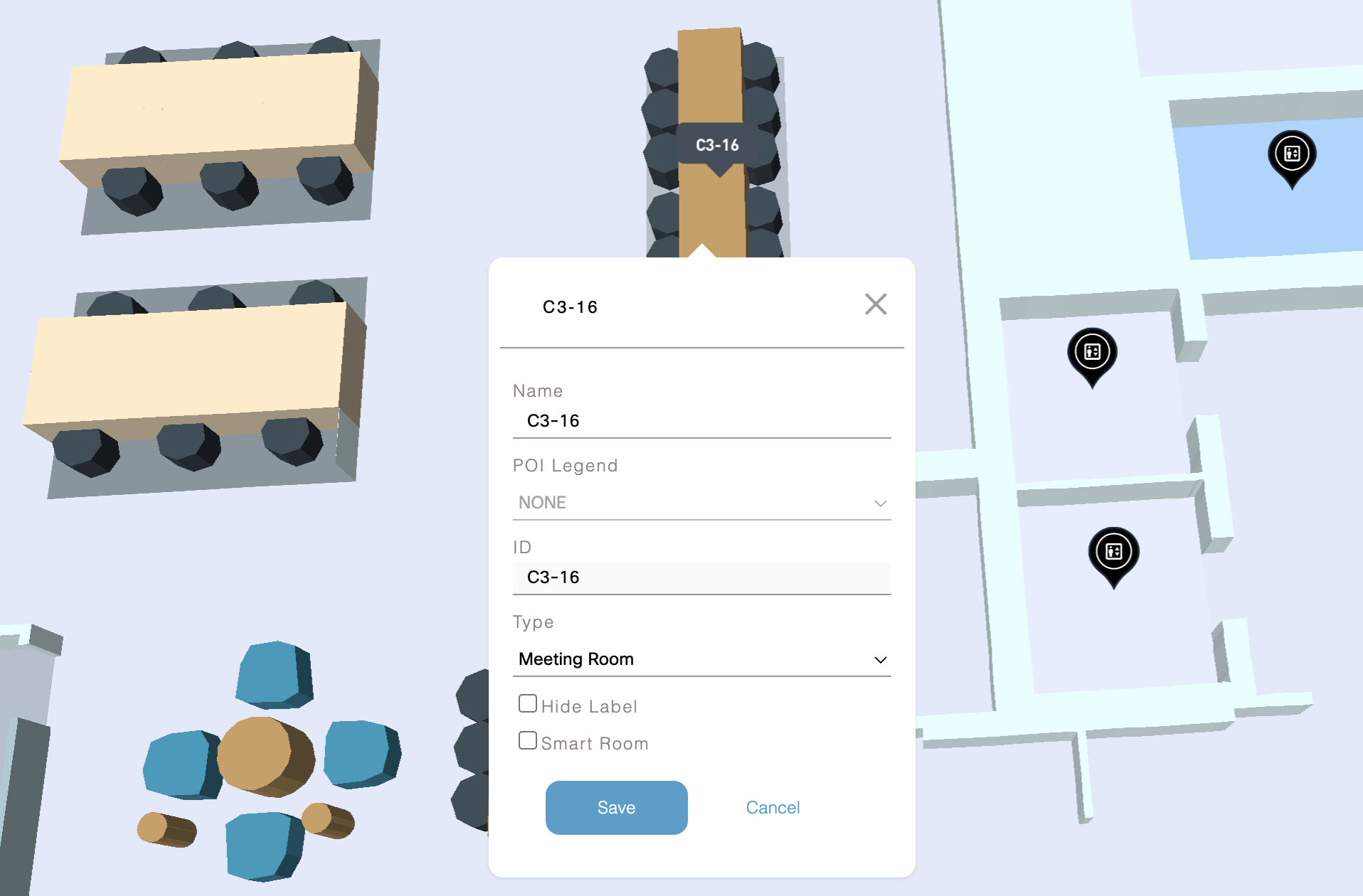
Digital Map Editor - under Setup > Locations & Maps > Digital Maps > View/edit maps, admins edit space types, names, and IDs
-
Space Manager app - admins manage and connect sensors to specific Space Types (e.g. Meeting Rooms can connect to Webex Workspaces and IoT Sensors, Workstations can only connect Webex Workspaces, and other Space Types cannot currently be managed and are only certain Space Types are visible on maps - learn more: Other Space Types)
-
Space Explorer Kiosk & Web App - end users search or visually scan for various Space Types based on icons, labels, or tapping on most spaces (each UI can be slightly different). The UI can utilize filters, search fields, icons, etc. to differentiate Spaces Types and allow end users to interact with them.
Importantly, each of the choices in UIs #1-3 determines what is shown in #3. This is fairly rigid by design to maintain consistency (while flexibility is possible over time and depending on the verticals and personas of end users). Any result is usually attainable by utilizing the existing rules. Generally, a calendar bookable, short term use, and shared space would be Space Type = Meeting Room. Similarly, a bookable personal use space for extended times would be Space Type = Workstation.
Meeting Rooms
Meeting Rooms are an essential space types for assigning Webex Workspaces and IoT Sensors in order to associate telemetry such as People Count, Presence, Temperature, Humidity, Carbon Dioxide (CO₂), Indoor Air Quality (IAQ), TVOC, PM2.5, Ambient Noise, etc. Meeting Rooms can also have a calendar assigned.
Meeting Rooms play a key role in end user and admin dashboard applications such as Space Explorer Kiosk & Web App, Indoor Navigation / Wayfinding, Space Manager, Space Utilization, Environmental Analytics, etc.
For managing Meeting Rooms, use Space Manager > Manage Rooms
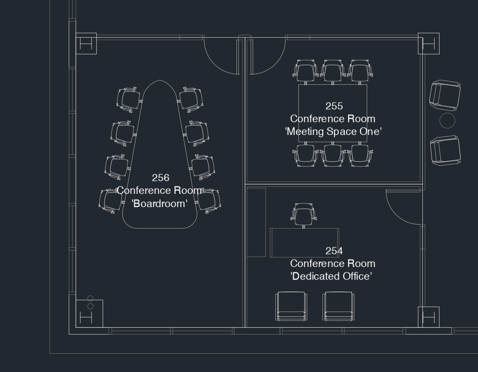
CAD File Best Practices for Meeting Rooms
-
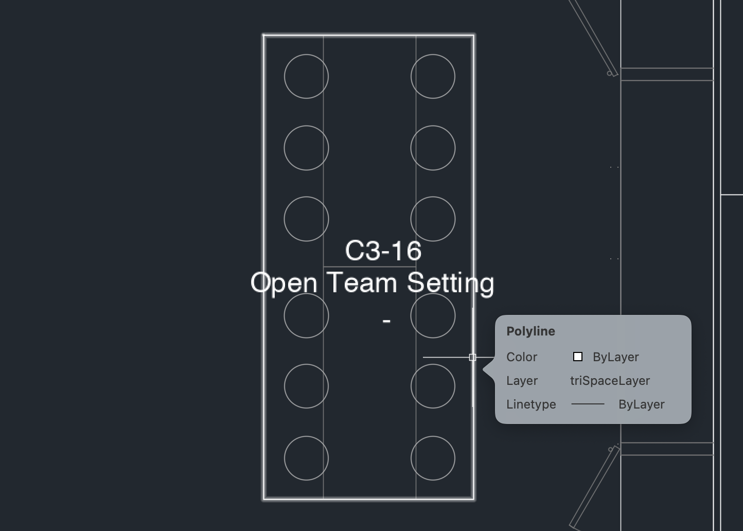
Outlines are not necessary, but helpful, for Meeting Room types in the CAD file produce easily identifiable spaces.
-
Meeting Room Names and/or IDs must be included in the CAD file layers.
-
Meeting Room furniture is highly recommended.
Workstations / Desks
Workstations expand on the special space types with assignable Webex Workspaces and IoT Sensors. A limited amount of telemetry (e.g. login status, Presence) is available for Workstations as compared to Meeting Rooms. A calendar cannot be assigned to a Workstation, but certain applications such as Space Explorer Kiosk & Web App do have a proprietary Cisco Spaces calendar automatically available as part of the Smart Desking solution.
For managing Workstations, use Space Manager > Manage Desks
CAD File Best Practices for Workstations
-
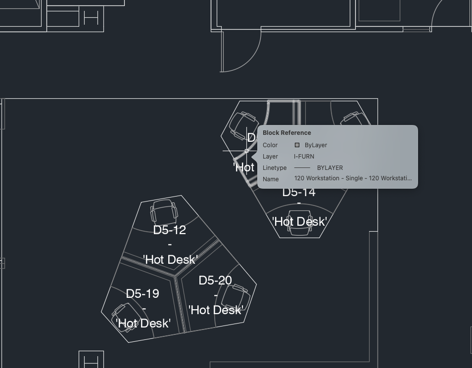
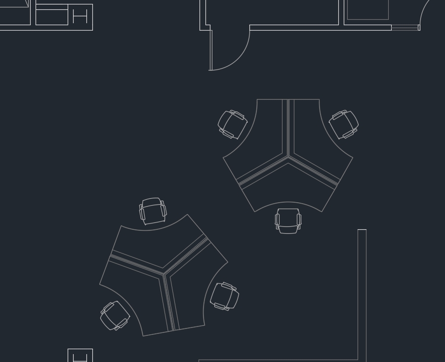
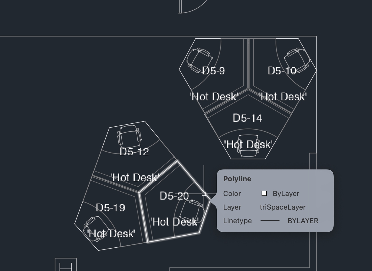
Outlines for Workstation types in the CAD file produce easily identifiable spaces.
-
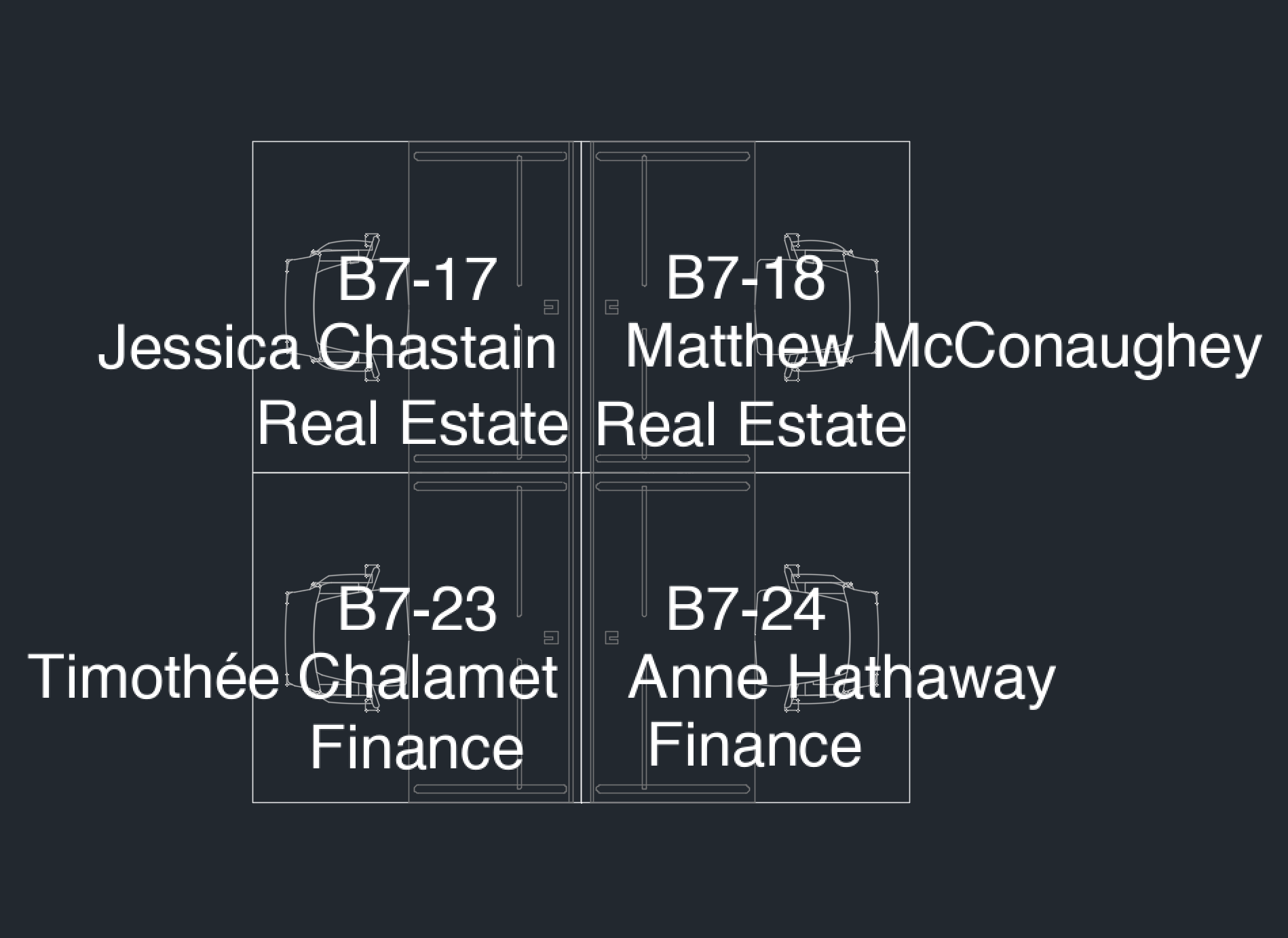
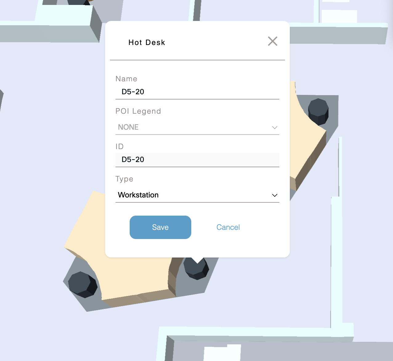
Workstation/Desk IDs (or names) must be included in the CAD file layers.
3. Workstation furniture is highly recommended.
-
No outlines and IDs/names will result in no editable workstations in the Digital Map Editor. They cannot be turned into bookable desks.
-
Do NOT include employee names in the CAD file if you do not want them to be processed by the AI and visible in the Digital Map Editor and other applications.
Other Space Types
Other spaces types besides the main two (Meeting Rooms & Workstations) have limited functionality throughout Cisco Spaces solutions.
Examples of other space type support:
-
Space Explorer Kiosk App - other space types may have an icon marker and they are searchable
-
Space Explorer Web App - other spaces types may have an icon marker
-
Space Explorer Indoor Navigation iOS App Clip - other space types are searchable and can be navigated to
Examples of other space types not being supported:
-
Space Manager - cannot manage other space types and assign sensors or devices
-
Space Utilization - cannot measure occupancy of other space types
-
Environmental Analytics - cannot assign sensors or devices to other space types to measure environmental data (note: sensors attached to the floor are included, but they will not be aggregated at the room level, only the individual sensor)
-
Space Explorer Kiosk App - cannot visualize sensor data in other spaces types
-
Space Explorer Web App - cannot book, search, visualize occupancy data, or click on other space types
Space Explorer Kiosk App – Quick Access Types
Cisco Spaces Digital Maps space types and styling may change with application updates. Refer back here for updates, but applications may be updated before this document. Always refer to the product UI over this document.
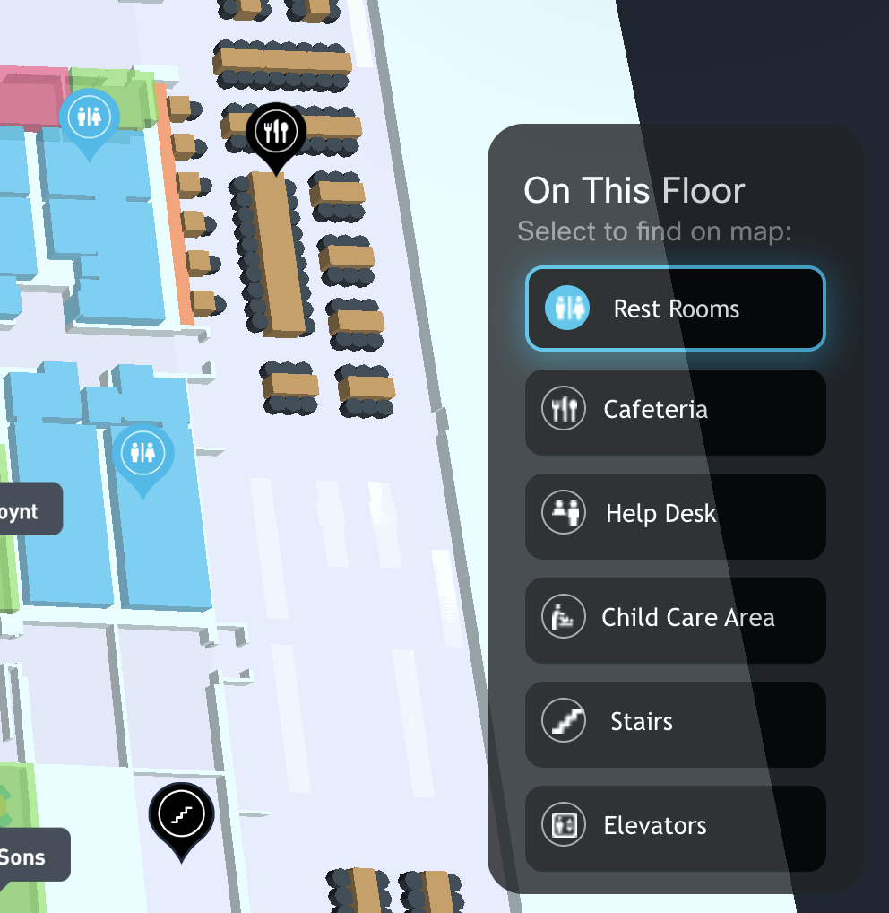
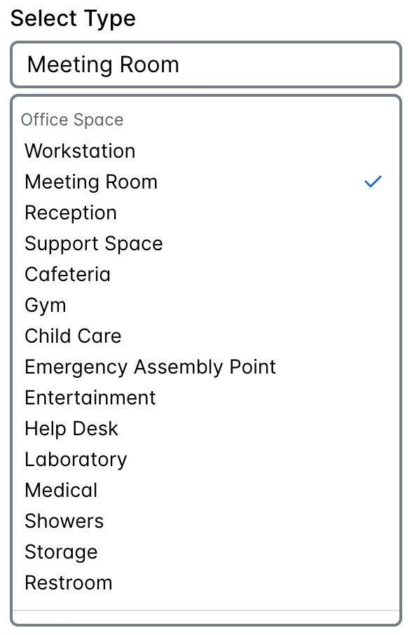
Supported types in the Digital Map Editor, under Setup > Locations & Maps > Digital Maps > View/Edit, which will appear in the Space Explorer Kiosk App as a quickly accessible / highlightable type and with special icons.
Space types cannot be switched between header sections (e.g. Office Space, Others). One exception: “Unknown” can be changed to any space type, but once saved cannot be changed between header sections.
Office Space
|
Space Type |
Quick Access Type |
Special Styling (e.g. icon) |
Searchable Space Name |
|---|---|---|---|
|
Workstation |
❌ |
✅ [icon only] |
❌ |
|
Meeting Room |
❌ |
✅ [name tooltip] |
✅ |
|
Reception |
❌ |
❌ |
❌ |
|
Support Space |
❌ |
❌ |
❌ |
|
Cafeteria |
✅ |
✅ [icon only] |
✅ |
|
Gym |
❌ |
❌ |
❌ |
|
Child Care Area |
✅ |
✅ [icon only] |
✅ |
|
Emergency Assembly Point |
❌ |
❌ |
❌ |
|
Entertainment |
❌ |
❌ |
❌ |
|
Help Desk |
✅ |
✅ [icon only] |
✅ |
|
Laboratory |
❌ |
❌ |
❌ |
|
Medical |
❌ |
❌ |
❌ |
|
Showers |
❌ |
❌ |
❌ |
|
Storage |
❌ |
❌ |
❌ |
|
Restroom |
✅ |
✅ [icon only] |
✅ |
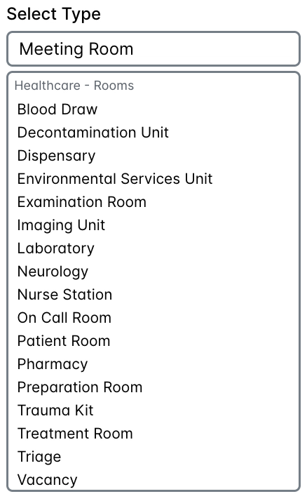
Healthcare - Rooms
|
Space Type |
Quick Access Type |
Special Styling (e.g. icon) |
Searchable Space Name |
|---|---|---|---|
|
Blood Draw |
|
|
|
|
Decontamination Unit |
|
|
|
|
Dispensary |
|
|
|
|
Environmental Services Unit |
|
|
|
|
Examination Room |
|
|
|
|
Imaging Unit |
|
|
|
|
Laboratory |
|
|
|
|
Neurology |
|
|
|
|
Nurse Station |
|
|
|
|
On Call Room |
|
|
|
|
Patient Room |
|
|
|
|
Pharmacy |
|
|
|
|
Preparation Room |
|
|
|
|
Trauma Kit |
|
|
|
|
Treatment Room |
|
|
|
|
Triage |
|
|
|
|
Vacancy |
|
|
|
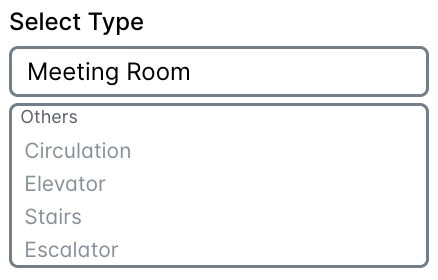
Others
|
Space Type |
Quick Access Type |
Special Styling (e.g. icon) |
Searchable Name |
|---|---|---|---|
|
Circulation |
❌ |
❌ |
❌ |
|
Elevator |
✅ |
✅ [icon only] |
✅ |
|
Stairs |
✅ |
✅ [icon only] |
✅ |
|
Escalator |
❌ |
❌ |
❌ |
Unknown
When the type was not recognized or could not be categorized by the Digital Map Artificial Intelligence (AI), then it will be marked as “unknown” and appear invisible, as in no styling is applied and other types or the world map underneath that space will show through.
Digital Map Editor Screenshots
Wayfinding Custom POI and Path Editor - Early Preview (August 2025)
The Space Experience app on the Cisco Spaces Dashboard is for admins to deliver and manage workplace experience outcomes through Cisco Spaces. Admins will have more control over delivering Pathfinding on the Space Explorer Kiosk app (e.g. lobby TV or touch display) and with the Spaces Premier for Wireless licensing blue-dot, turn-by-turn Wayfinding via iOS App Clip and Android Google Play app.
Learn more about deploying Indoor Navigation here: https://runbooks.ciscospaces.io/docs/cisco-spaces-indoor-navigation-runbook-cisco-valid
This preview explains the high level concepts and common use cases for adding and editing Custom POIs and Paths in the upcoming Space Experience > Wayfinding section of the Cisco Spaces Dashboard.
Note: The design and Custom POI options may change before production release.
https://app.vidcast.io/share/9212137b-d72c-4cfe-b588-a82d715e05b3
CAVEATS & TIPS
-
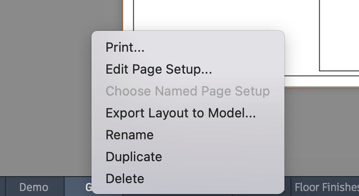
How do I export a complex CAD (.dwg) file from AutoCAD with multiple layers that I do not want to include for the Digital Map Pro?
If the CAD (.dwg) file has as a “Layout” tab with the exact layers and objects needed:
a. Right-click on the tab (bottom of the application window on macOS)
b. Choose the “Export Layout to Model…” option
The resulting CAD (.dwg) file will only contain the layers and objects visible in that Layout.
-
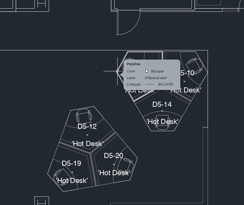
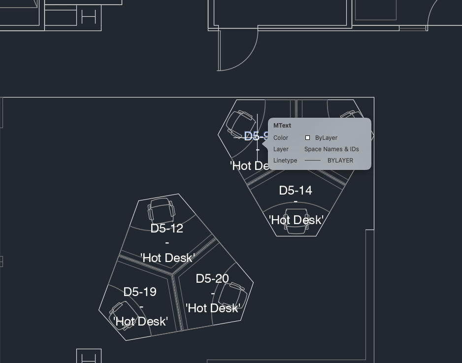
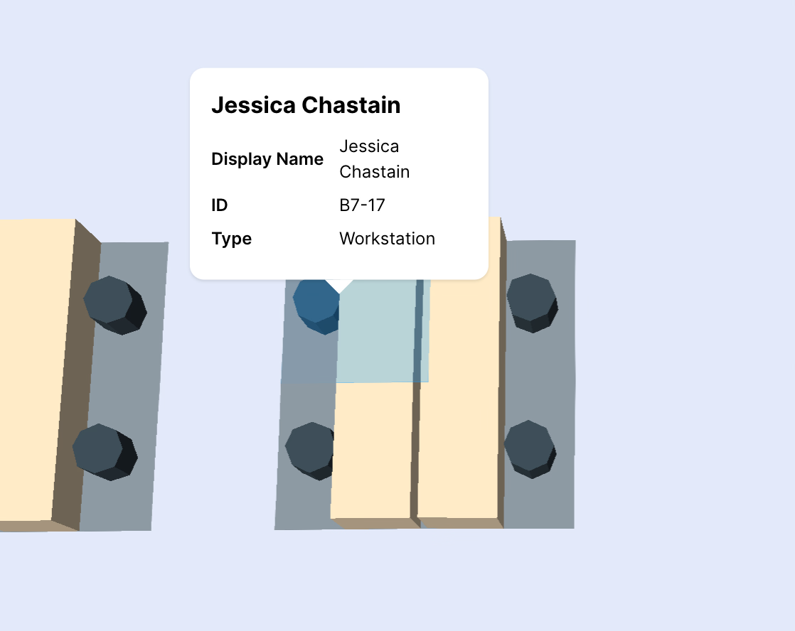
What is the difference in outcome between individual desk IDs and a label for a group of desks?
By labeling desks individually, each desk will be editable under Setup > Locations & Maps > Digital Maps > View/Edit (Digital Map Editor). Surrounding a group of dekss
|
CAD File |
Digital Map Pro |
|---|---|
|
|
|
|
-
What kind of changes can I expect when re-uploading CAD files to modify existing Digital Maps?
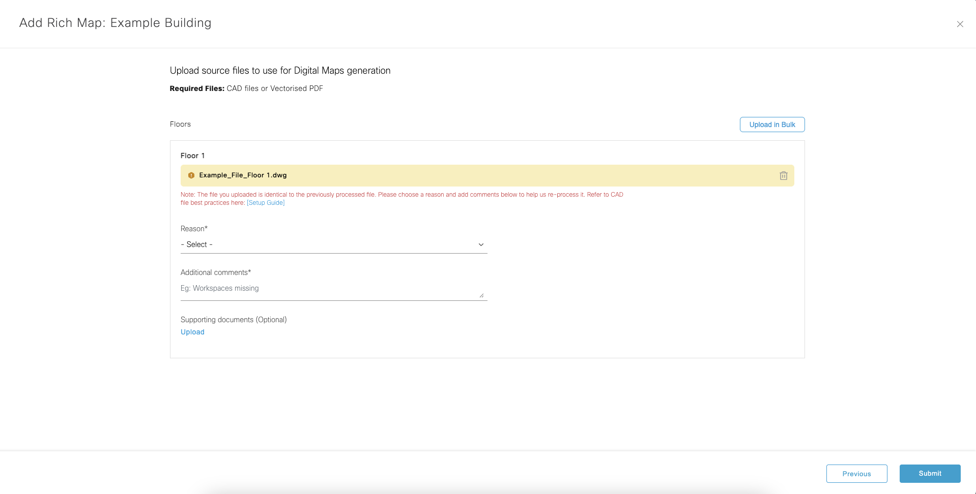
There are a few scenarios where intentionally or unintentionally re-upload CAD files may be necessary:
a. After uploading CAD files for the first time (before finished processing), canceling is perfectly acceptable. Canceling the processing will make it possible to choose different files (if chosen mistakenly or realizing some changes were needed in the file contents) or add/remove files from processing. Otherwise, waiting for the first round of processing (per building) is necessary before adding or removing any floors.
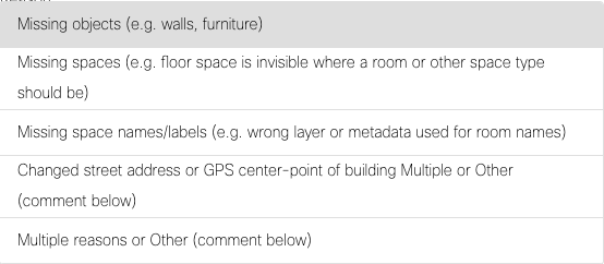
b. After map processing has completed and there are missing objects in the Digital Map Pro (among other reasons - see below), re-upload the exact same file as before and a new reason, comments, and attachments modal appears inline. The reason dropdown categories are:
i. Missing objects (e.g. walls, furniture)
ii. Missing spaces (e.g. floor space is invisible where a room or other space type should be)
iii. Missing space names/labels (e.g. wrong layer or metadata used for room names)
iv. Changed street address or GPS center-point of building
v. Multiple reasons or Other (comment below)
Provide additional comments to help our mapping team review the AI processed maps and provide a faster/better update. Optionally include an image with annotations for a holistic picture of the corrections needed.
c. Similar to scenario 2 above, the Location Hierarchy has changed and the exact same files are used to create the same Digital Map Pro in a new Location. Use the appropriate reason dropdown option: “Changed street address or GPS center-point of building”. This also applies to re-uploading when the Cisco Spaces mapping team has declined/rejected a CAD file because the building could not be found on the world map. Please provide additional details in the comments field to help the mapping team accurately align the Digital Map Pro on the world map for accuracy in outcomes.
Note: a building can only exist in one place in the world and cannot be duplicated across multiple Locations in the Location Hierarchy or in multiple Cisco Spaces Tenants. Only the most recent upload will work correctly for outcomes such as Pathfinder on Space Explorer Kiosk and Indoor Navigation App Clip for turn-by-turn blue-dot wayfinding indoors.
d. After CAD files are finished processing and Published, it is safe to upload additional floor files or modify existing with new file versions. Follow the same workflow as before, but either create new floors (w/ metadata) or check the boxes for floors to update specifically to change the files.
Note: re-uploading unchanged floors is not necessary. When re-uploading, only check the boxes for the floors that need to be updated.
e. Currently, it is not possible to delete individual floor Digital Maps. Please open a TAC case to request help removing unwanted files until this feature is available in the dashboard.
f. Currently, it is not possible to process individual floors in parallel in the same Building. Either cancel a map processing job and re-upload or wait for the current process to complete and Publish. Then, proceed with the next upload. Multiple parallel floor uploads in the same Building will be possible in a future update.
-
Will Webex Workspaces remain connected to the Meeting Rooms after re-uploading CAD files to modify Digital Maps?
There is not currently a way to edit a Digital Map directly with new walls, rooms, or furniture after a CAD file has been processed. To make physical layout changes, upload a modified CAD file to the Cisco Spaces AI Digital Map platform, and it will attempt to carry forward metadata (e.g. Webex Workspace connection, Meeting Room name manual edits). Generally, metadata associations stay intact in the database as long as the internal identifiers have not changed. Typically, a furniture layout will not create new identifiers, but physically moving walls or changing a room name in the CAD file will create new entities on the backend and erase previous manual edits in the Digital Map Editor (e.g. room name). IoT Sensor associations should carry forward as well.
The Digital Map Editor (under Setup > Locations & Maps > Digital Maps) provides an interface to make lightweight, metadata changes to previously processed CAD files. For example: space names, space IDs, and space types. While it is quite easy to manually make these edits, the source CAD files do not receive those edits.
It is important to always keep your source CAD files up to date so that when they are re-uploaded for processing at any point in the future to update the physical layout, space metadata (e.g. name, ID, type) remains intact and is not reverted. If this metadata remains identical to the previous version uploaded and processed, manual edits will carry forward. Any diff in a new file version will overwrite manual edits that conflict.
If new or moved rooms' names are close matches to their respective Webex Workspaces, auto-connecting in Space Manager > Manage Rooms should reduce manual work to associate all collaboration devices with rooms post-processing CAD files.
Note: Webex Workspaces must be assigned to a Location and a Floor in Control Hub to benefit from auto-connect based on name matching. IoT Sensors will need to be re-added if physical spaces or name have changed significantly, as they do not benefit from auto-connection by name.
-
What do I need to keep in mind for Campus Wayfinding (i.e. indoor-outdoor and inter-building navigation)?
There are several factors that affect Campus Wayfinding and decrease time to process CAD files:
a. Locations in the Location Hierarchy MUST be grouped under the same common level above the Building level.
b. A group of Buildings (i.e. Campus) MUST fit within a 100km² area (roughly 10km x 10km). To be safe, the distance between the 2 furthest buildings must be no more than 8km.
c. Geo-alignment on the world map is essential. Elements included in the CAD files (e.g. bridgeways, paths, etc.) can help align Buildings to ensure smooth transitions between Buildings in a Campus.
-
How can I set the default map view (pitch, bearing, zoom, latitude/longitude)?
https://app.vidcast.io/share/24c8b89d-9dea-4b2a-a856-65a44cfb4813
-
How can I hide rooms or areas of the map?
There are a few methods to hide elements from the map:-
The simplest way to hide a meeting room label and the room from search results is to change the Space Type to a type without a label/icon and not searchable (in the table above).
-
Recommended: if you would like to hide / block out / fill in the space boundaries entirely by replacing with a wall object with 100% height, add a Hatch Pattern in the source CAD file that fills in the area to be hidden.
-
During CAD file upload workflow, include notes and annotated images to explain which rooms to hide / block out / fill in.
-